|
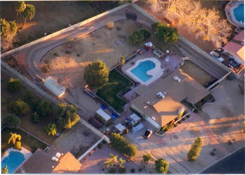
Over the years we've come by a few aerial photos of the Arizona & Pacific Railroad. Since the grass and most plants are dormant January's not the most picturesque time of year but many of the trees lose their leaves allowing better visibility of the Railroad from the air. In January of 2002 a pilot friend gave me a birds-eye view of the A&P RR and an excuse to buy a telephoto lense for my camera. As you can see from this 1/12/2002 photo the rail was basically half a loop through the backyard with a long spur and a switch yard to store the cars. This photo was taken just 1 month after the 12/15/02 inaugural run of the Phoenix.
|
|
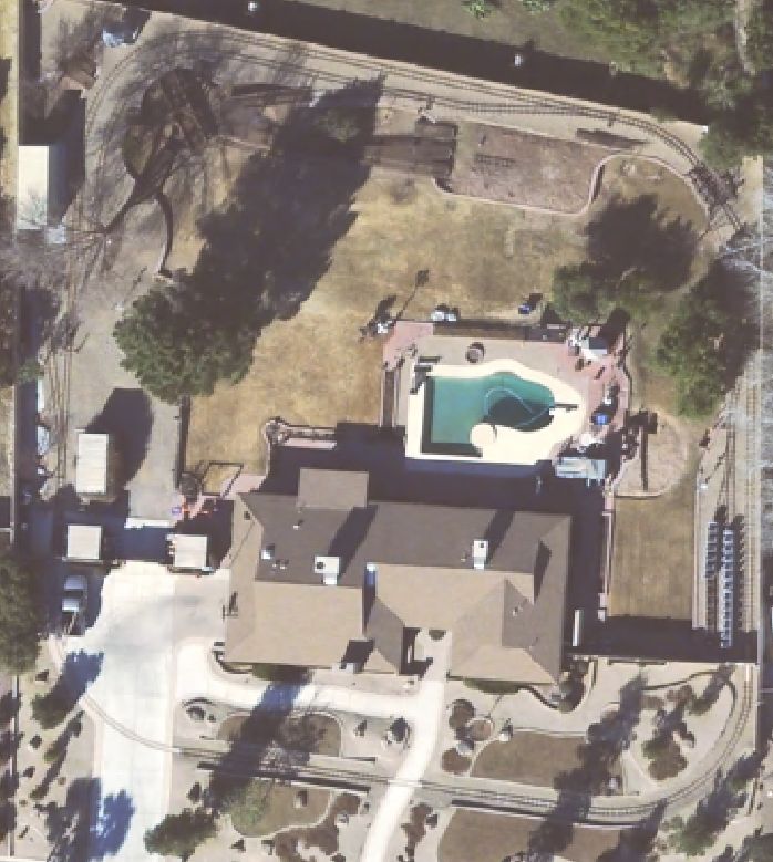
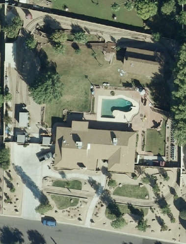
Here's an aerial photo taken by the county assessor's office. This one was taken in January of 2006. The track runs through the front yard and the main line completely circles the property. The spur from 2002 has become a long siding and the car barn has been moved. The turntable, 4 additional trestles and watertank are also visible in this photo. You can see the observation platform was undergoing renovation awaiting the pedestrian bridge and fireplace that completed construction during the 2006 season.
|
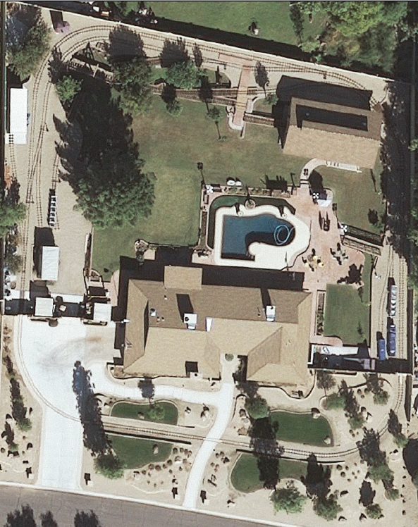
Here's a Google satellite photo from 2006. Comparing it with the earlier 2006 photo above you can see the city's new requirements forced us to move the planned location of the enginehouse. In this photo the retaining wall has been adjusted and some of the dirt was moved to the future site of the enginehouse.
|
Here's a photo from Microsoft Virtual Earth in early 2007 showing the footer for the engine house had been started and the transfer table was in place. Unfortunately Microsoft Virtual Earth does not provide images as large as the other satellite photos or the aerial photos I took.
|
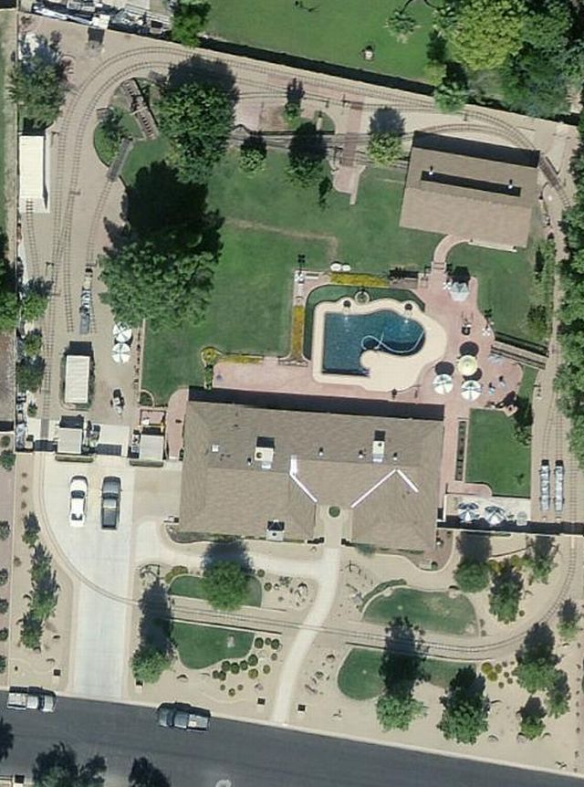
Here's the "2008" aerial photo taken by the county assessor's office. This one was taken on November 3rd of 2007. The engine house was still under construction and the roof had just been shingled days before the photo was taken. The clerestory was still open on the sides, there were no doors and the brick walkway was still a month away.
|
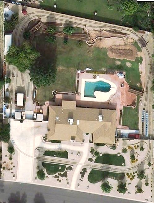
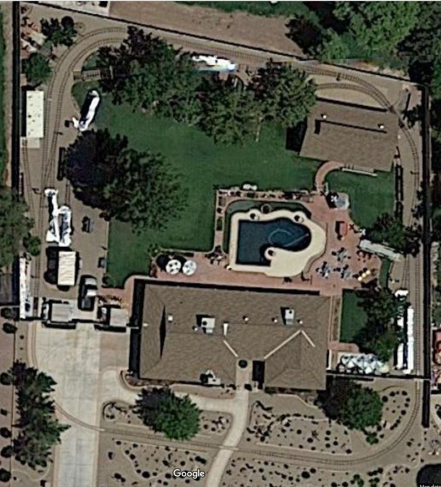
Here's the "2009" aerial photo taken by the county assessor's office. This one was taken on November 12th of 2008. There are a number of additions to the railroad that can be spotted between the November 2007 and November 2008 photos. The completion of the engine house isn't visible from these aerial photos but the walkway leading to the front door and brick loading platform are easily spotted in this most recent photo. If you look real closely you can see the siding from rock creek in the shadows of the engine house and the G-16 B unit is sitting in the east yard.
|
Here's the "2012" aerial photo taken by the county assessor's office. It was taken some time in late September or early October of 2011 since the front yard still has grass instead of the xeriscape that was installed in October and the backyard has the scar from the hose bib trench that was dug in September. There are many changes between the October of 2011 photo (below) and the November 2008 photo (above). The loading platform was lengthened in March of 2010. Verde Junction is under construction in the 2011 photo. The cars in the east siding have moved. The switch stand display is in place. Several aluminum patio umbrellas that arrived in 2010 are easy to spot and if you look very carefully you can see the light poles that were installed along the right-of-way in 2009. Many of the projects that took place during that time frame were inside the engine house (ceiling installation and restoration work on S-16 engine #37) or inside the garage (G-16 #582 restoration) and are not visible in these photos.
|
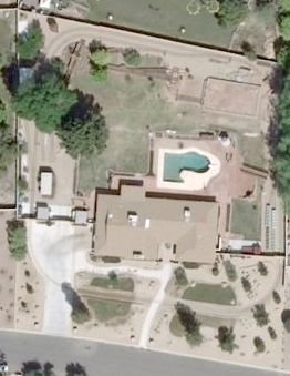
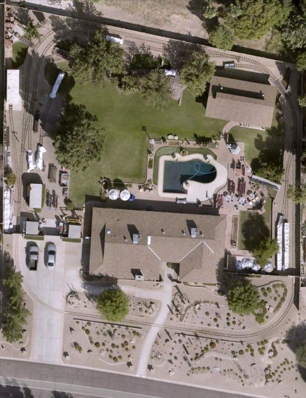
Here's the "2020" aerial photo from Google Maps taken some time before August of 2019
|
|